It has been raining. Perhaps I mentioned that before? If I am repeating myself, forgive me, but the weather has been repeating itself as well. We had a break in the rain, which is a darn good thing or we would have been trying to buy a kayak to get to the grocery store. But it’s started again and the forecast is not looking like we’re going to dry out soon.
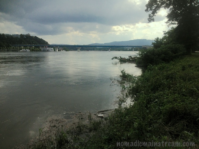
A few days ago, they closed off a portion of the park we walk in because a good bit of it was under water. Tisen and I walked down to the riverfront where it was open and I snapped a couple quick iPhone images of the water level.
While I was standing there, I ended up in conversations with 3 separate neighbors who have lived here many years. They were all amazed by the water level–none of them remembered seeing it that high before.
I took some time going through old photos to find some comparison shots. So, here is my photographic evidence that the river is really high:
- Shot taken 2 days ago under the Market St Bridge–note the water is up to the grass in the image:

- Shot taken in the spring showing the launch ramp that’s supposed to be in the same spot under the Market St Bridge, but it’s completely under water in the above photo.

- Shot from 2 days ago looking downstream–the top of a Mimosa tree is visible (although dark). It looks like a tiny peninsula in the upper right quadrant of the image.

- Shot from last year of the same bank showing the same Mimosa tree as it normally appears–not submerged.